My friend Mike recently invited me to go with him and our mutual friend Dan to the Dolly Sods Wilderness in West Virginia. Of course, I said "yes" because it had been a while since I had seen them. Backpacking in the Sods is always a treat that is hard to pass up. The 17,371 acre Dolly Sods Wilderness is situated on a unique high-altitude plateau with boreal forests, windswept meadows, flagged trees and an extensive trail system that is perfect for backpacking. For more about the area, check out the USFS website. For more about the history, the Sierra Club has an excellent article.
Overview and Difficulty
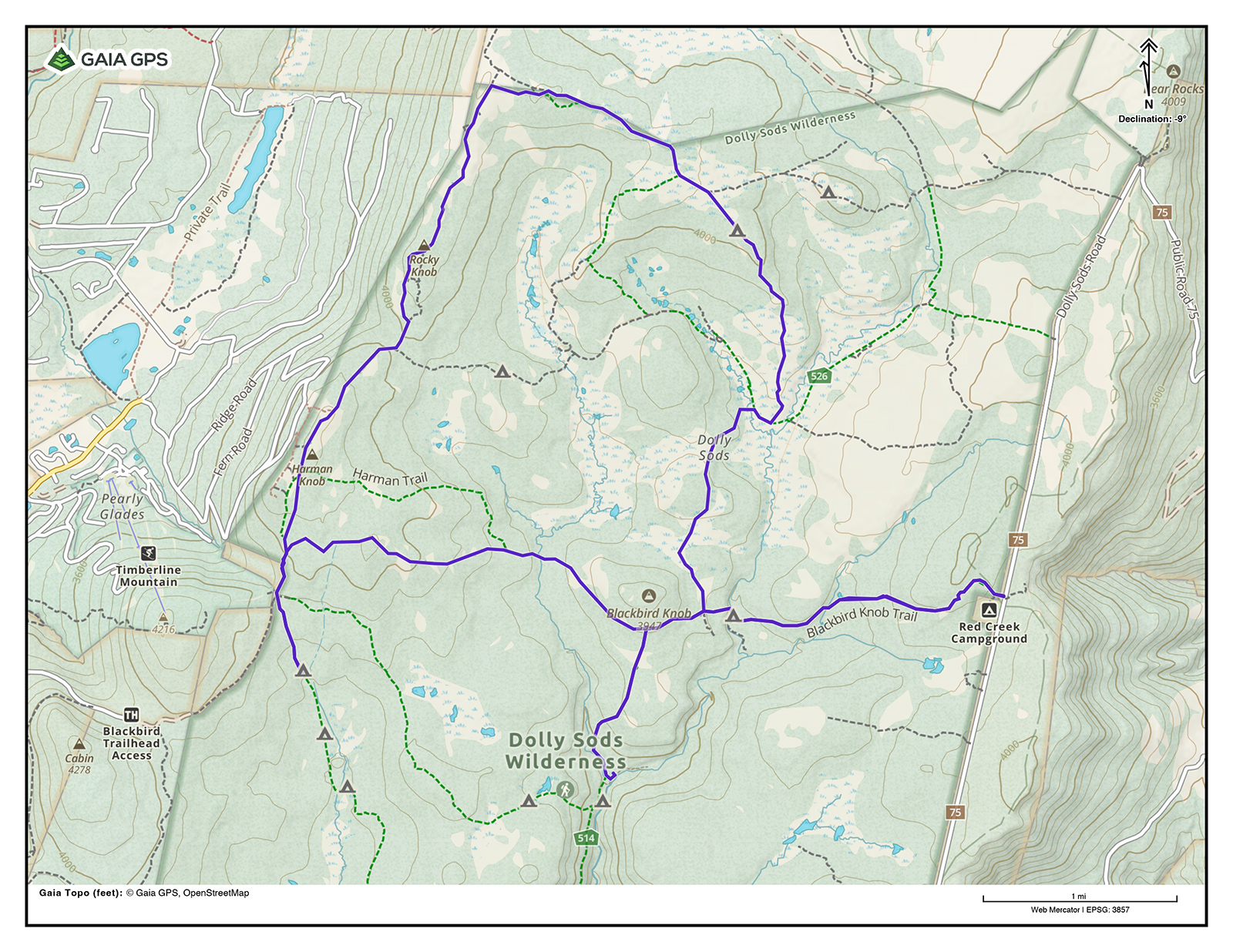
There are many configurations of trails that can be combined for loops or out-and-backs. For this adventure, we elected to hike a loop that wraps around the northern part of the plateau near Blackbird Knob and Upper Red Creek. Here is an overview of our plan.
- Total Distance (approx.): 17.5 miles
- Total Elevation +Gain/-Loss (approx.): +2,244 ft./-2,484 ft.
- Difficulty Rating: Intermediate to Advanced
- Challenge Level: Can be difficult due to the absence of blazes, the potential for sudden weather changes, and the constantly wet and muddy trails that will inevitably soak hikers' feet.
- Navigation: Trails are not blazed. There are only signs at intersections. Bring multiple forms of navigation.
- Crowds: It's a popular destination and trailheads can get crowded. Especially on weekends.
- Reward: Being in the Dolly Sods wilderness is like entering a different world, offering a privileged opportunity to hike through its unique boreal forests and tundra-like bogs while taking in diverse landscapes and expansive views from trails like Rocky Ridge and Bear Rocks.
Table of Contents
Our Plan
Trip Dates: 11/22/25-11/24/25
After extensive research, texts, Google Docs and map creation, we settled on a route and then obsessed about the weather. Three weeks out, Dan noted that it looked like we would be getting a lot of snow. Two weeks out, the chances for snow diminished, and it looked more like we would get significant rain and high winds. One week out, the rain chances diminished a bit, but it still looked like it would be very windy. Three to four days out, the wind forecast looked more pleasant. One to two days out, rain was back in the forecast but not a total washout; winds were holding steady at "bearable" and temperatures were holding steady at "comfortable late fall backpacking weather."
Given the tumultuous forecast, we considered Cranberry Wilderness as a backup. It would be more sheltered from the wind because of the dense forest, and we could also camp at a lower elevation.
After refreshing our weather apps repeatedly, it finally looked like the weather would cooperate. Mike made the call and we all agreed: Dolly Sods.
Here's the breakdown of our planned mileage for each day:
| Segment | Distance | Elevation +/- | Duration |
|---|---|---|---|
| Day 1: Blackbird Knob trailhead to Camp 1 | 5-5.5 miles | +757 ft./-860 ft. | ~2:30:00 |
| Day 2: Camp 1 to north section back down to Camp 2 | 9 miles | +826 ft./-1,005 ft. | ~4:30:00 |
| Day 3: Camp 2 back to Blackbird Knob trailhead | 3.1 miles | +726 ft./-354 ft. | ~1:15:00 |
- Day 1: Blackbird Knob trailhead to Camp 1: 5-5.5 miles
- Day 2:Camp 1 to north section back down to Camp 2: 9 miles
- Day 3:Camp 2 back to Blackbird Knob trailhead: 3.1 miles
Maps
The plan Mike hatched was to start at the Blackbird Knob trailhead, use the Blackbird Knob Trail to cut west across the wilderness to the western border and then head south on Big Stonecoal Trail to find a campsite for night one. On day two, we would hike north back up Big Stonecoal to Rocky Ridge Trail and follow that to the northern tip of the wilderness to catch Raven Ridge Trail. We would head east-southeast until it intersects with Dobbin Grade and take a right, heading west. After a short time on Dobbin Grade, we would take a quick left onto Upper Red Creek Trail and head south. We would take that back down to Blackbird Knob Trail and decide whether to head west to Red Creek Trail to find a campsite or head east to find a site along Blackbird Knob Trail. The decision would be based on water conditions, the weather and the distance we were comfortable covering. On day three, we would have an easy hike out along Blackbird Knob Trail back to the cars.
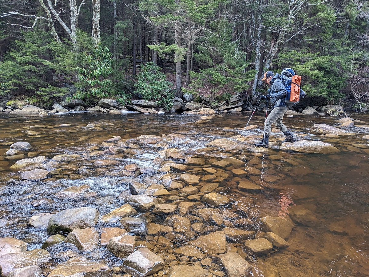
Some of the main unknowns for this route were trail conditions ("Were they going to be very muddy and wet?") and creek crossings ("How high would the water be?"). We paid particular attention to the crossings, knowing we would be crossing three major creeks: Alder Run, Red Creek and Left Fork Red Creek.
For this trip, we used a combination of AllTrails, Gaia GPS, and CalTopo to help us plan. Below is the Gaia GPS map along with a link to the map. Check out the route on GaiaGPS.
Campsites
Night 1
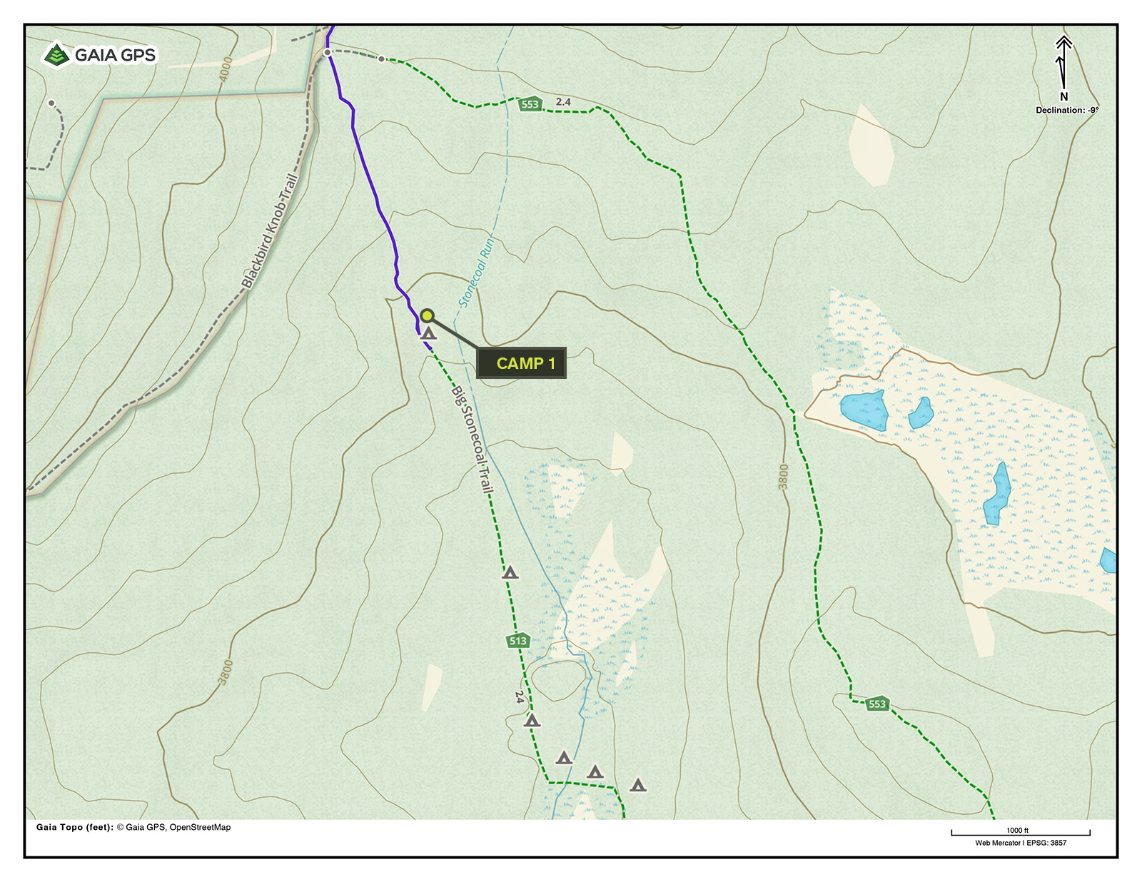
For the first night, our plan was to camp somewhere along Big Stonecoal Trail. The map indicated a campsite about half a mile from the Big Stonecoal intersection at an elevation of about 3,700 feet. We also noted on the map that there is another cluster of campsites a bit farther down the trail at about 3,600 feet. We decided we would snag the first one if it was available and conditions were not too windy.
Night 2
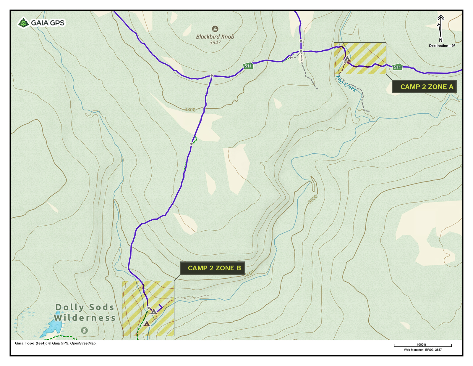
For the second night, the plan was to either head down Red Creek Trail to a cluster of campsites at an elevation of about 3,000 feet (Zone B on the map) at the junction of several major creeks or camp along Blackbird Knob Trail, somewhere near Red Creek (Zone A on the map). Zone A would be preferred, but if the weather was windy, we would camp at Zone B because it is lower in elevation.
Getting There
There are three main ways to access the trails of the Dolly Sods Wilderness. On the western side of the Sods, there is the Blackbird Knob parking lot along Forest Road 80. This lot requires a permit for overnight parking, which can be obtained from the Canaan Valley National Wildlife Refuge office at least four days before visiting the area.
On the southern end, there is the Red Creek trailhead near Laneville, West Virginia. This parking lot is large but can still fill up, so arrive early. As of this writing, no permit is required to park here. This lot is located at the base of the mountain before Forest Road 19 begins to ascend the plateau.
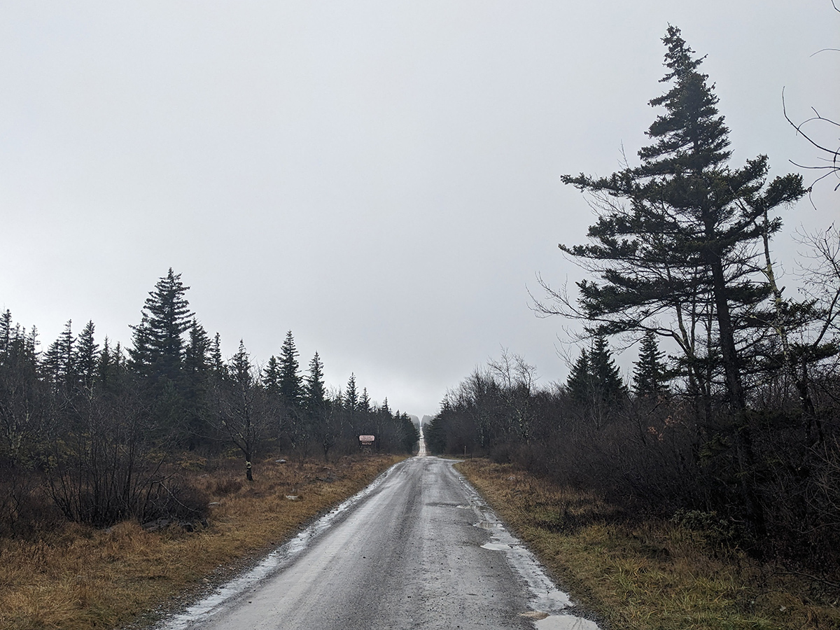
The other option, which we used on this trip, is to park at one of the many trailheads along Forest Road 75 on the plateau. There are many small lots at each of the major trailheads. Bear Rocks trailhead at the northern end has the largest lot and fills up fast. Our plan was to park at the Blackbird Knob trailhead, which is near Red Creek Campground. As of this writing, no permits are required to park along Forest Road 75.
- Blackbird Knob (west) parking lot: 39.027953, -79.409414
- Red Creek trailhead: 38.972807, -79.397557
- Blackbird Knob (east) parking lot: 39.033251, -79.314349
Day 1
5.72 miles | +797 ft. of gain | -873 ft. of loss
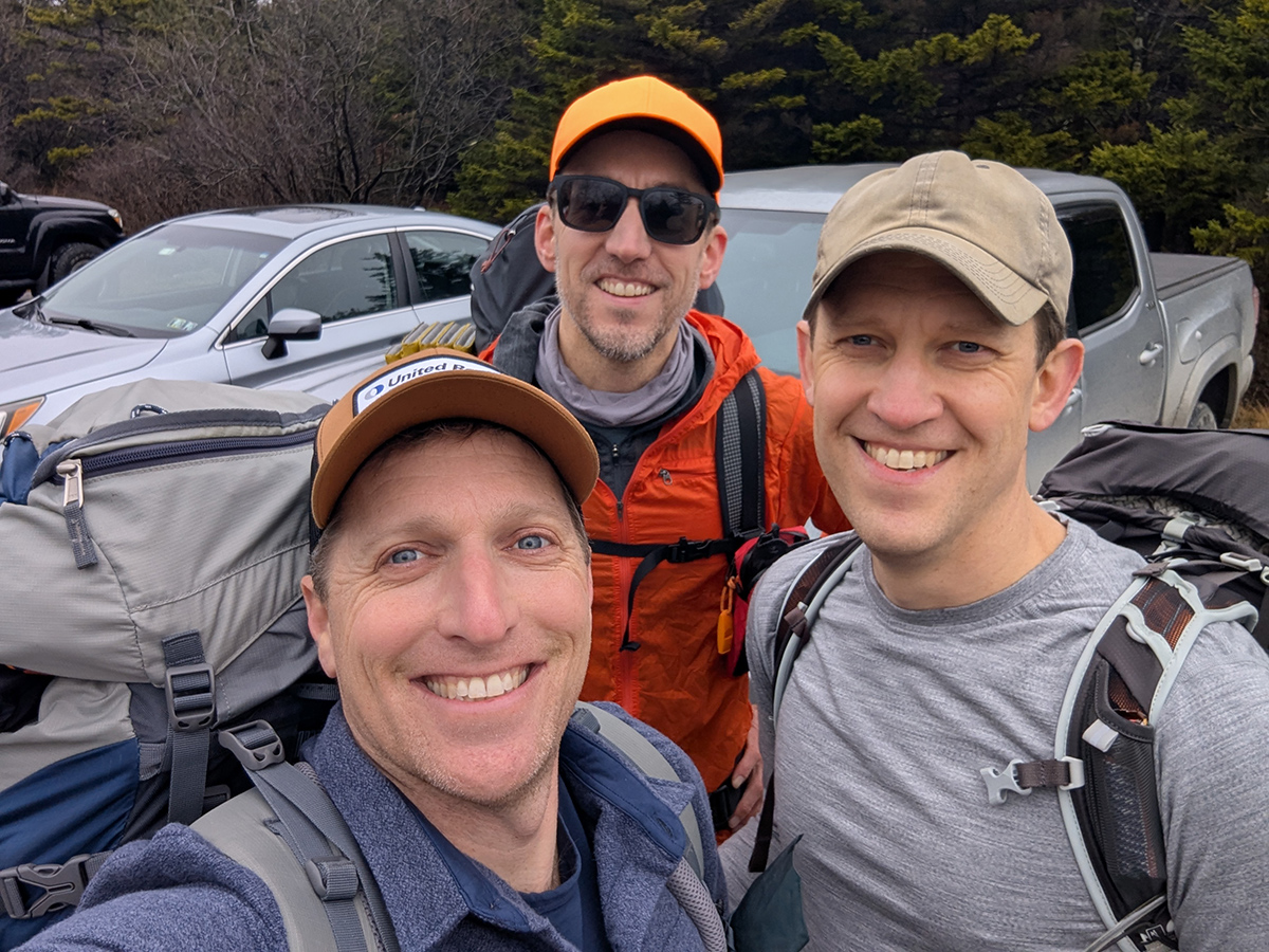
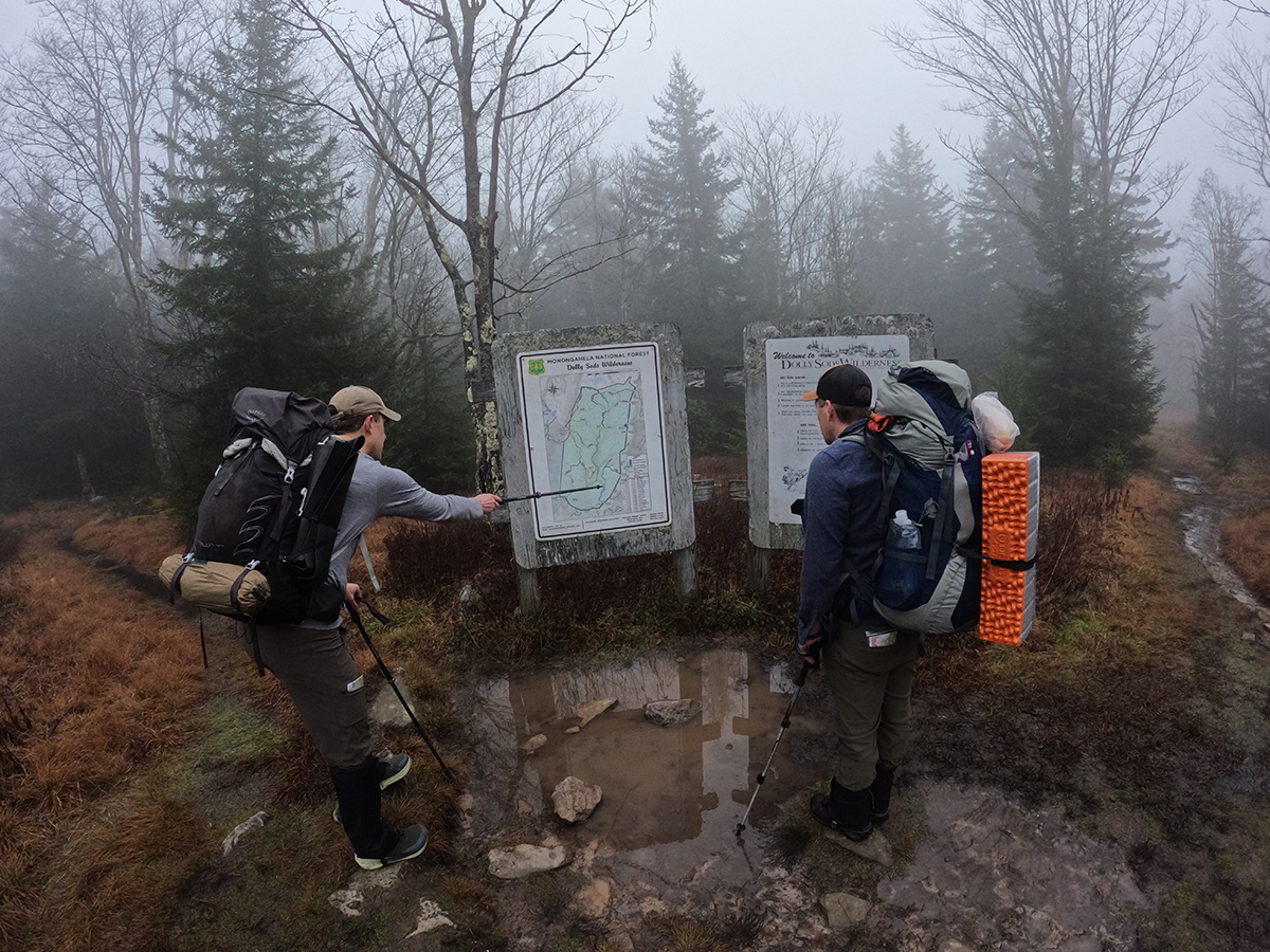
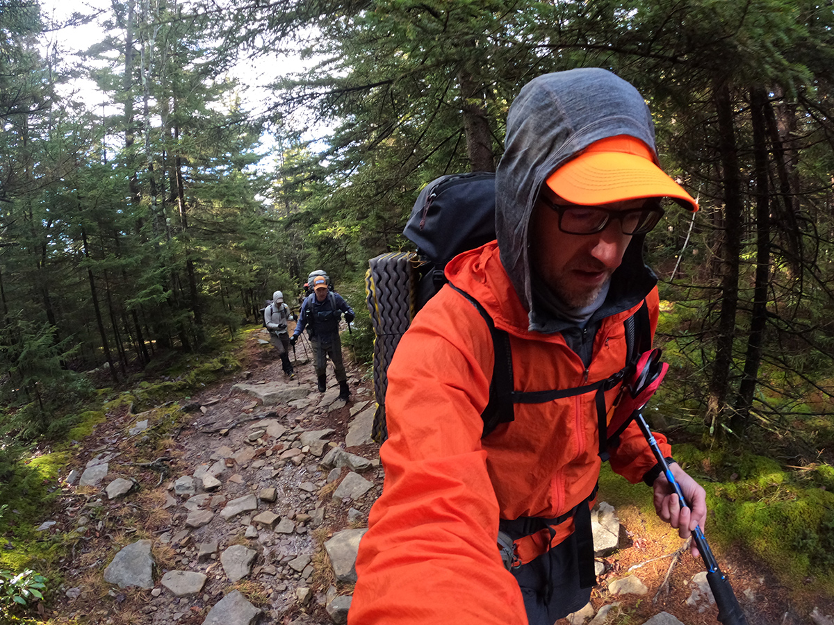
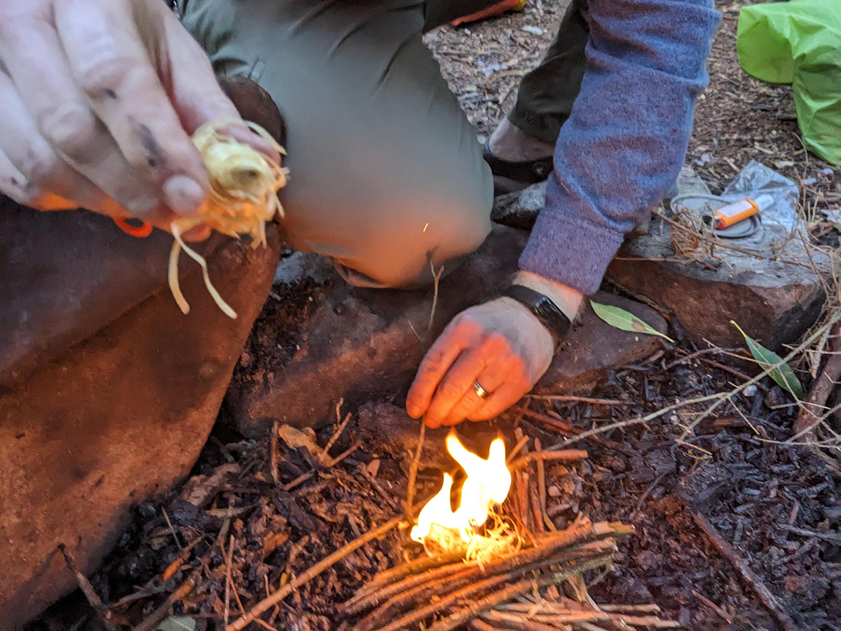
We met at the Blackbird Knob trailhead on Forest Road 75 around lunchtime. I drove from Columbus, OH, Dan from Pittsburgh, PA, and Mike from Greensboro, NC. The conditions were gray, a bit foggy, slightly windy, and right on the border of shorts weather (for me). Temps were in the low 40's, maybe even upper 30's. Trailheads weren't too crowded but there was still a fair amount of activity along FR 75. There were a couple of backpacking groups at the Bear Rocks trailhead and lots of dayhikers. We said our hello's and caught up on life stuff, got our packs situated, and then headed out on the trail. As we were crossing the dirt road, we ran into the trail steward who gave us some maps. He also mentioned how wet conditions were and that it would be difficult to keep a fire going. With that, we headed out onto the trail.
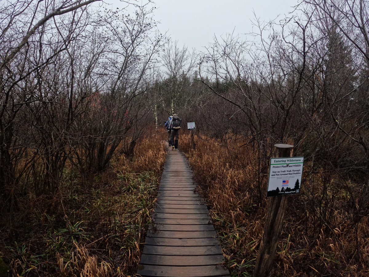
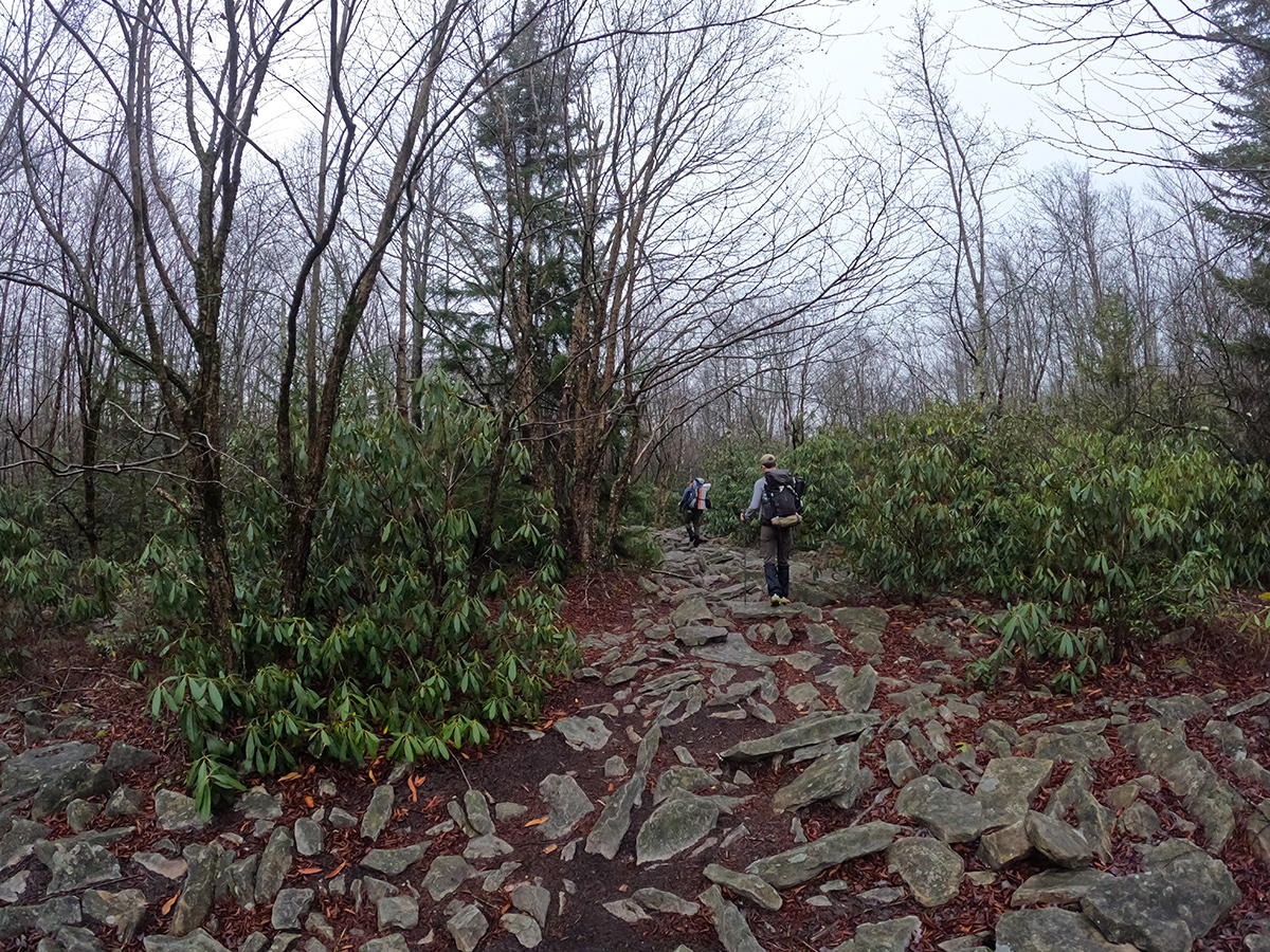
Blackbird Knob trail starts off along a boardwalk that crosses a marshy area and then gently descends down through forests and wind swept meadows to Alder Run, our first creek crossing. The crossing was easy and we made it to the other side with no issues because of the conveniently placed rocks. Then we hiked up and over the southern shoulder of Blackbird Knob and continued the traverse across the wilderness area.
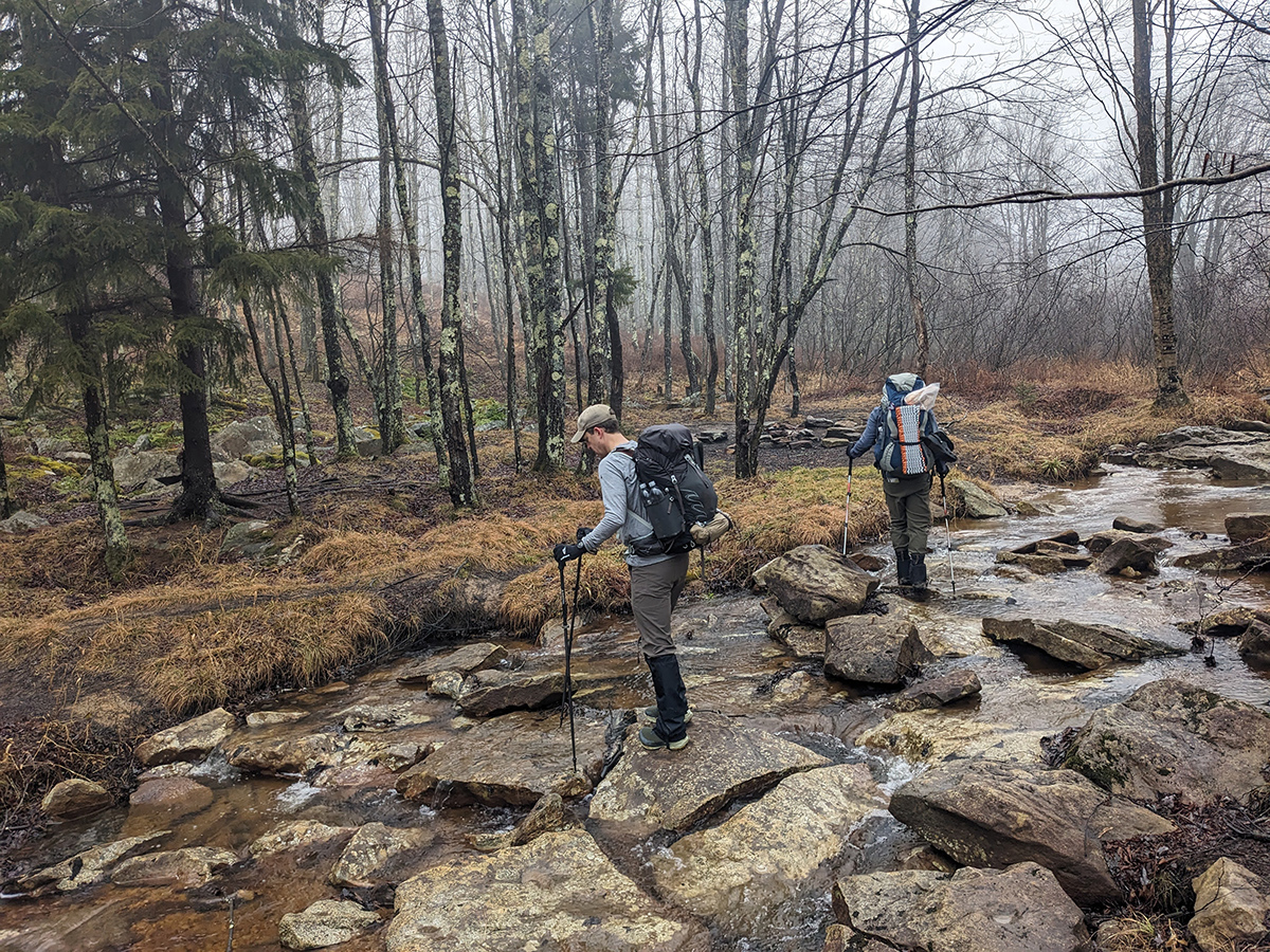
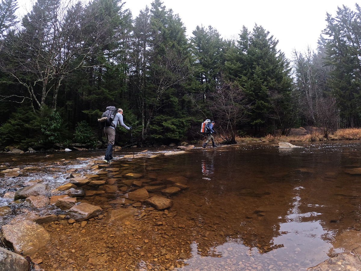
Soon after passing up and over the southern portion of Blackbird Knob, we descended again and encountered our second creek crossing, Red Creek. Because of the recent rain, water levels at Red Creek were above most of the normally exposed rocks which meant we had to get our feet wet. The conveniently placed rocks provided enough of a shallow path for us to safely cross but there was no escaping the water. From that point on, we were dealing with very wet, saturated trails.
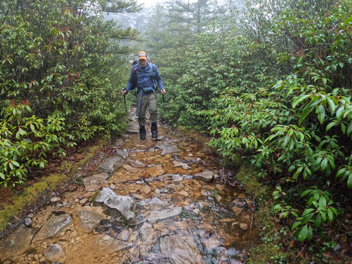
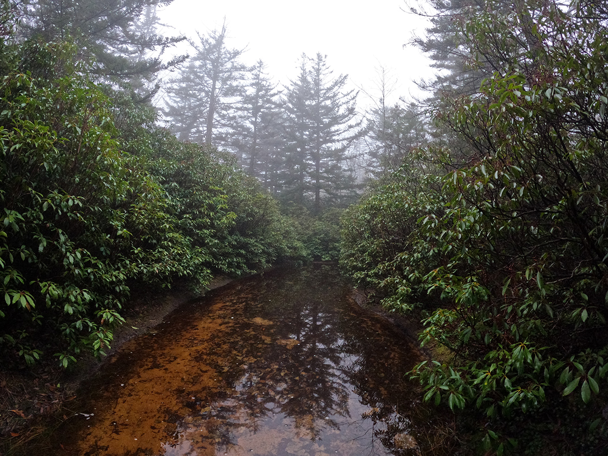
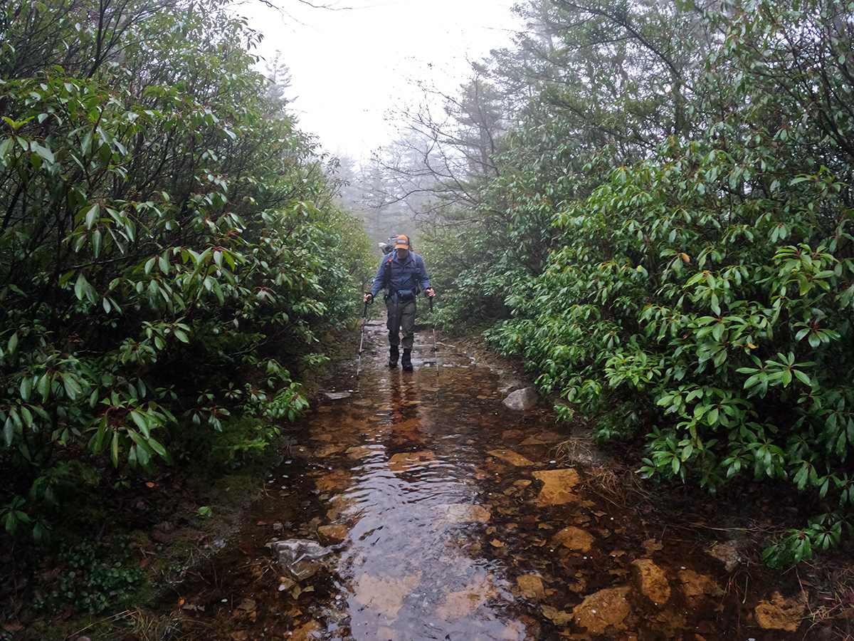
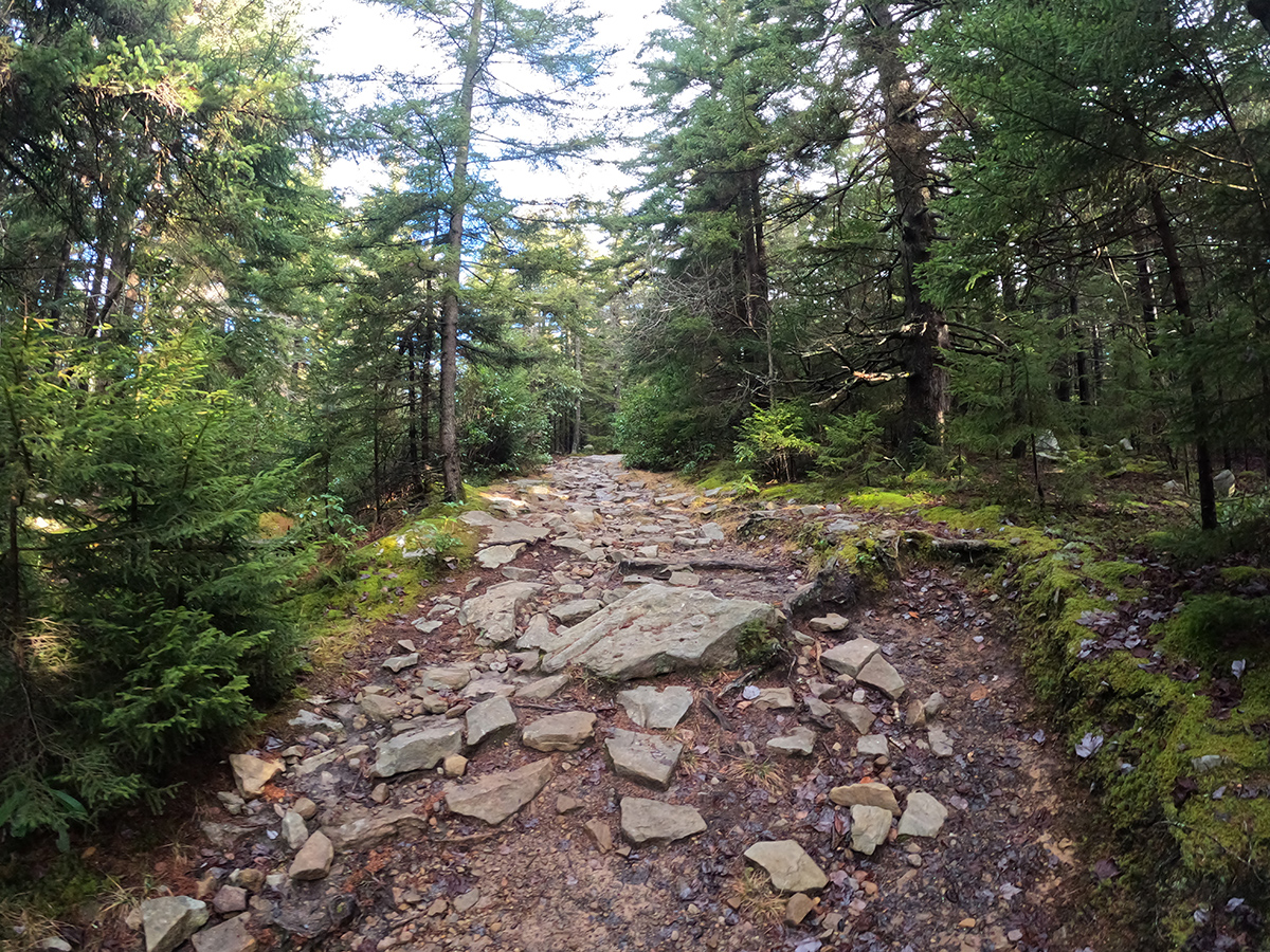
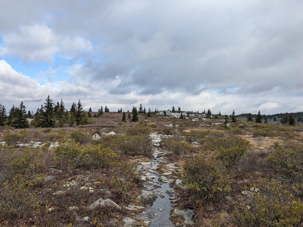
The section between the Red Creek crossing and Harman Trail was a bit of a climb and then it eventually leveled off. As it leveled off, it was clear that the water really didn't have a place to go and the trails became creeks. Shin deep in places, there was really no way to rock hop or avoid it because of the thick rhododendrons and Mountain Laurels on either side of the trail.
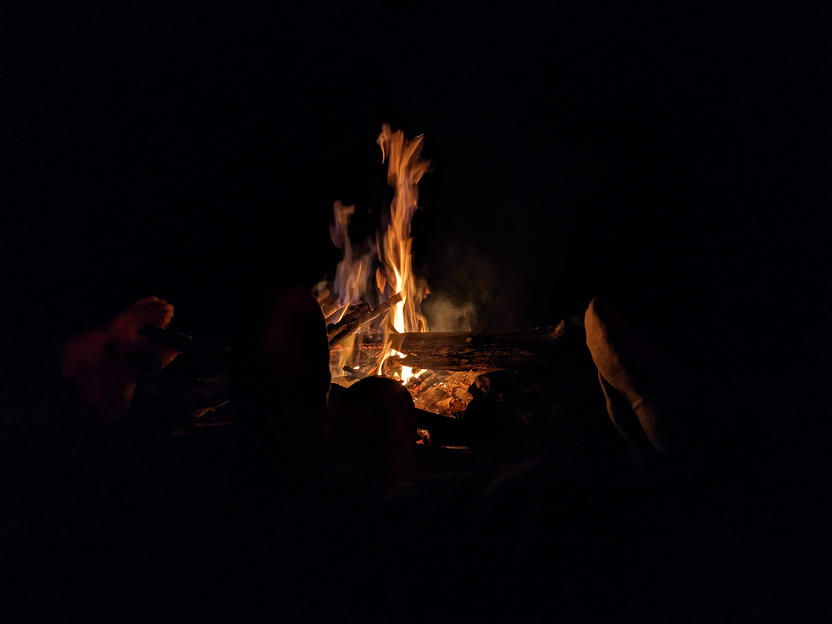
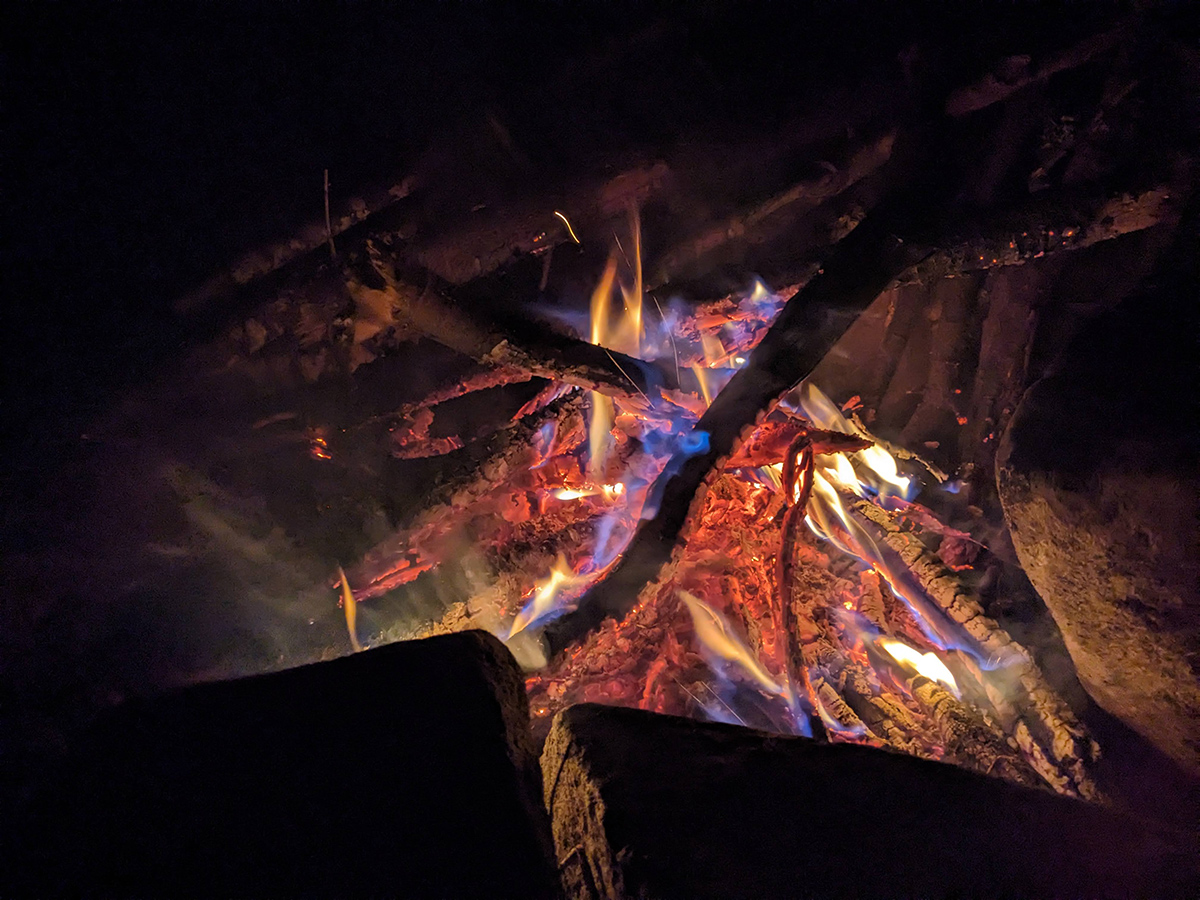
Blackbird Knob Trail eventually popped out at the intersection of Breathed Mountain, Big Stonecoal, and FR 80. We paused for a moment to check out the sign to familiarize ourselves with the area and then headed down Big Stonecoal to find our campsite. Conditions were still cool, gray, and wet and a campfire sounded great as a way to warm up and dry out our feet. Upon finding our campsite, priorities were finding dry wood, locating water and getting camp set up. Day 1 complete!
Day 2
8.76 miles | +909 ft. of gain | -1,099 ft. of loss
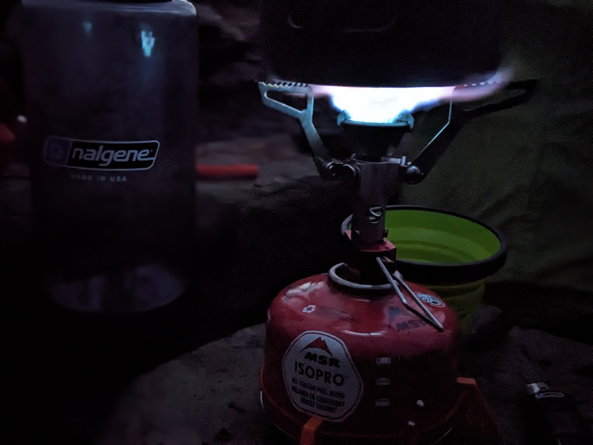
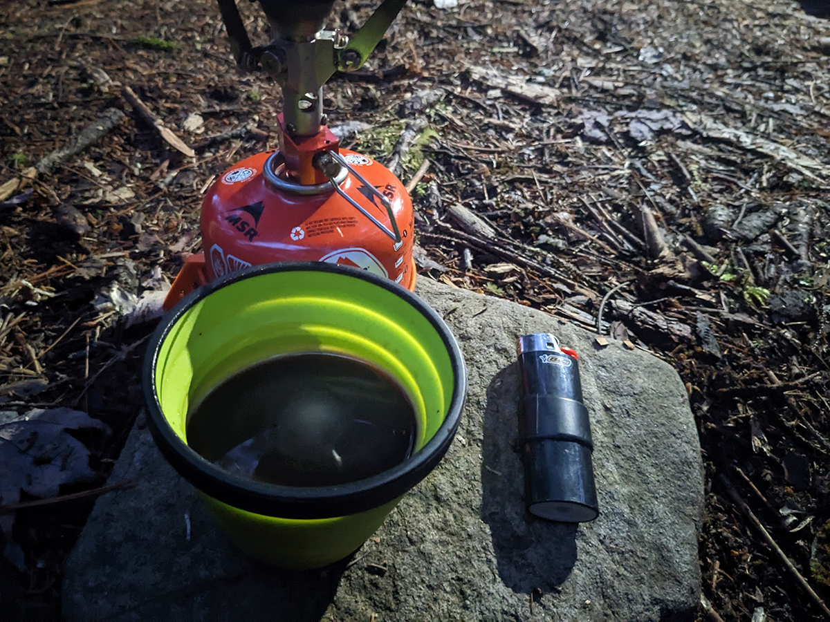
We began the day around 6:00 a.m. with some coffee and breakfast while we sat and enjoyed the sunrise. Seeing the warm glow of the sun after the previous day's dreariness was a welcomed sight. We didn't have a super long distance to cover on day 2 so we took our time, enjoying several cups of coffee and each other's company while we talked about life, backpacking gear, and brainstormed ideas for new products like DIY ultralight camp shoes.
We got on the around 8:45 a.m. and headed up to Rocky Ridge Trail. As we ascended to the ridge and emerged from the spruce forest, we were greeted by the bright morning sun but also the bitter cold wind. Just before the trail left us totally exposed above the tree line, we put on our shell jackets. As we hiked through this section, we checked our route via both GPS on our phones/watches and physical maps every 15-20 minutes just to make sure we were on trail. There were a couple of spots where there were no cairns or indications of a trail and we had to do a bit of route finding, especially near the summit of Rocky Knob. But otherwise, it was pretty easy to follow.
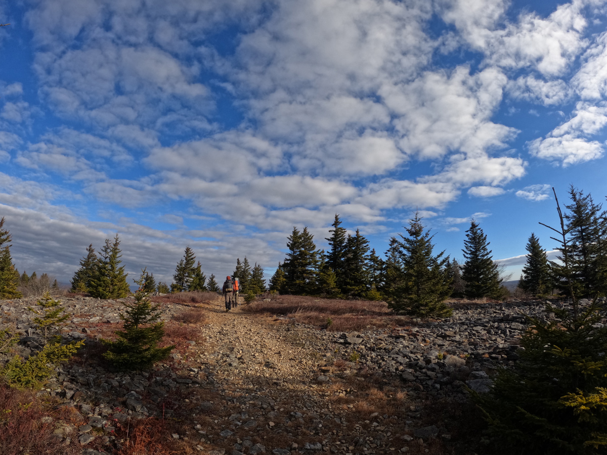
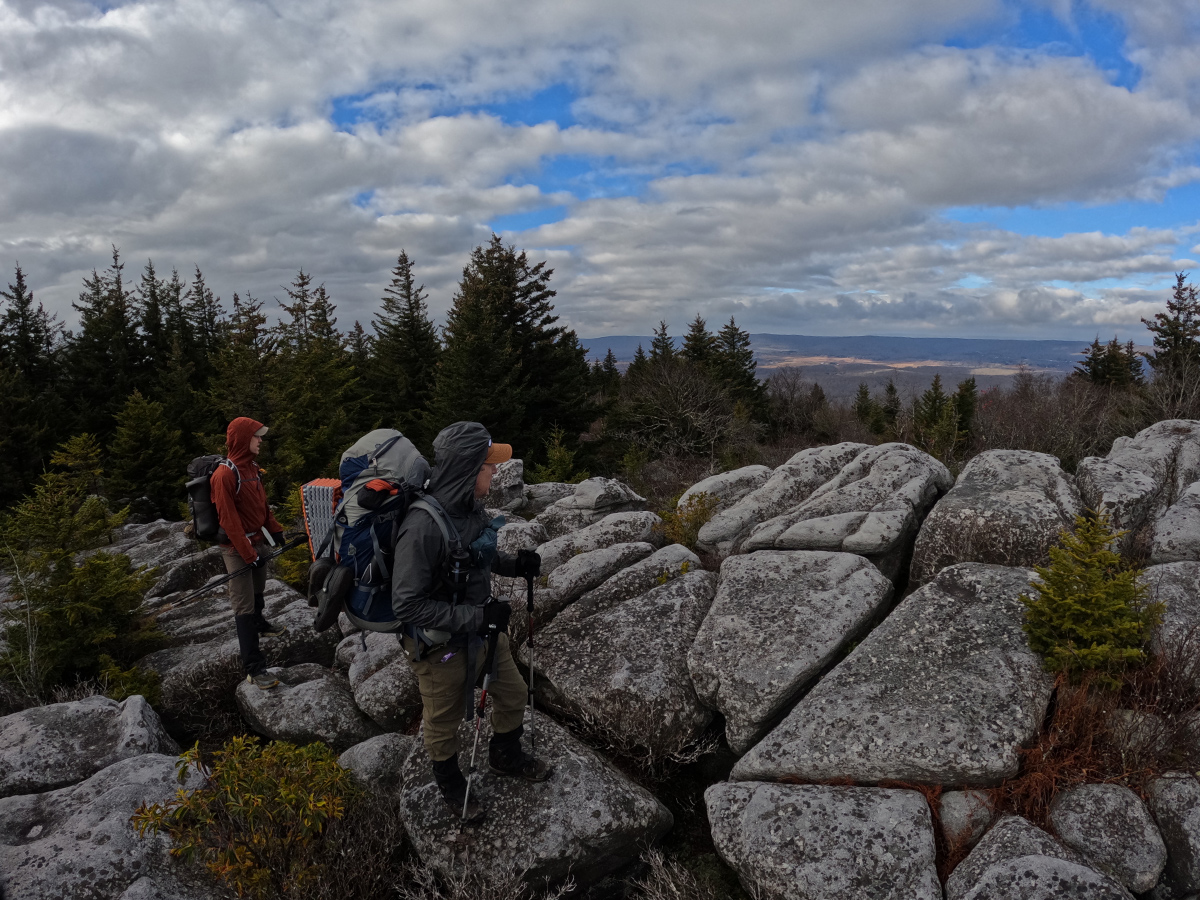
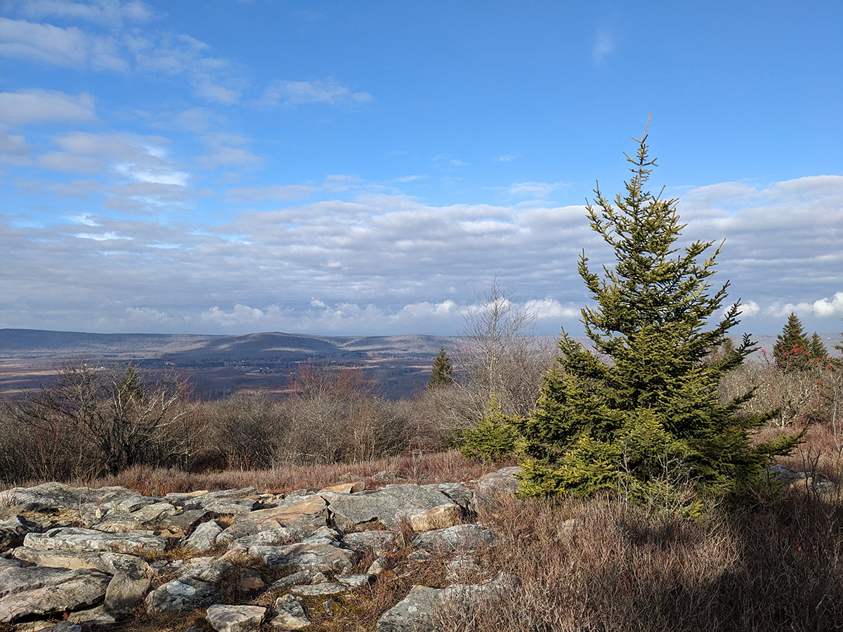
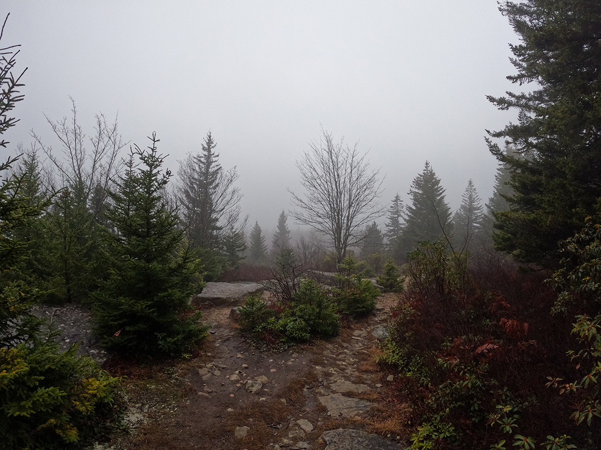
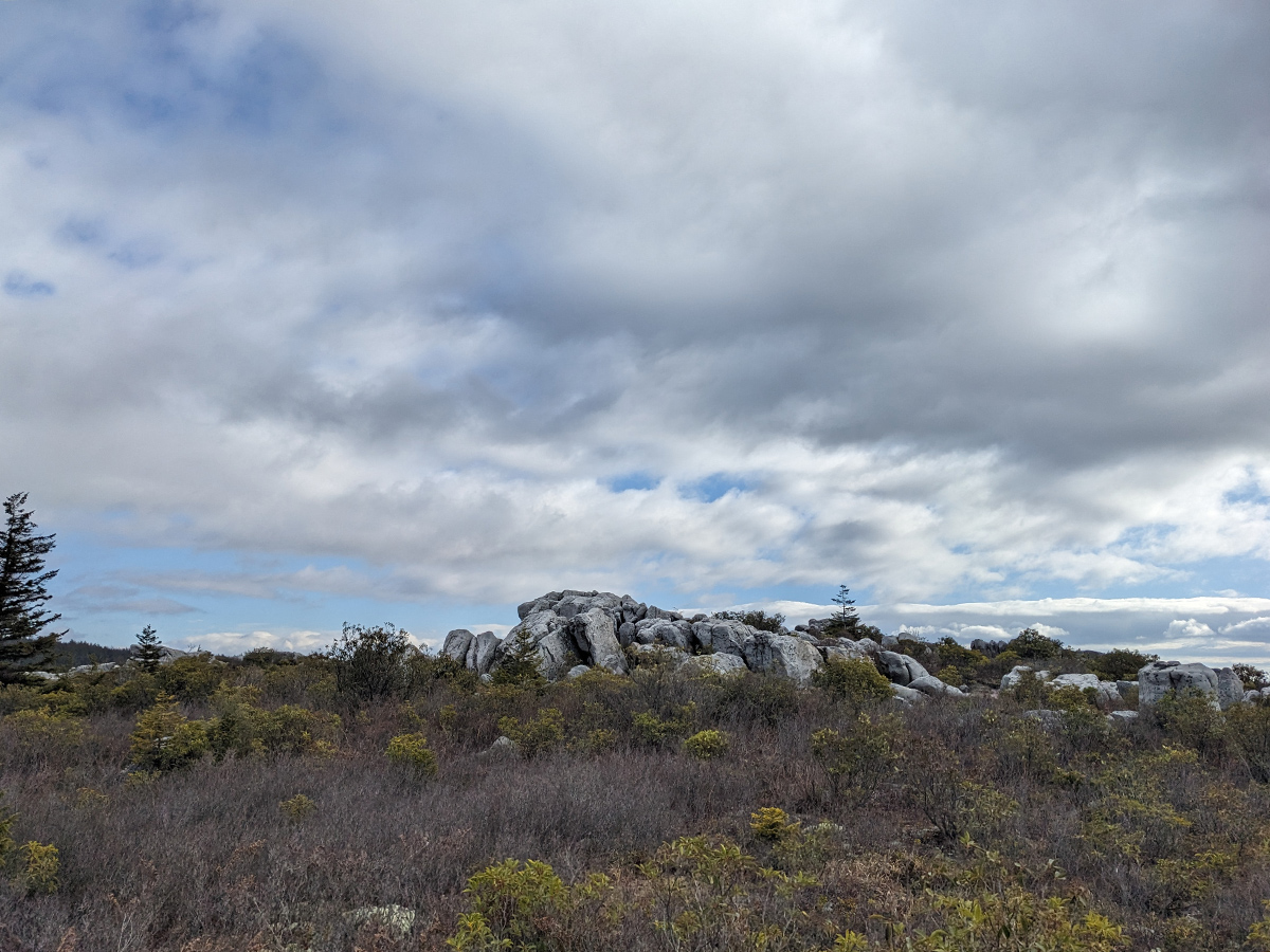
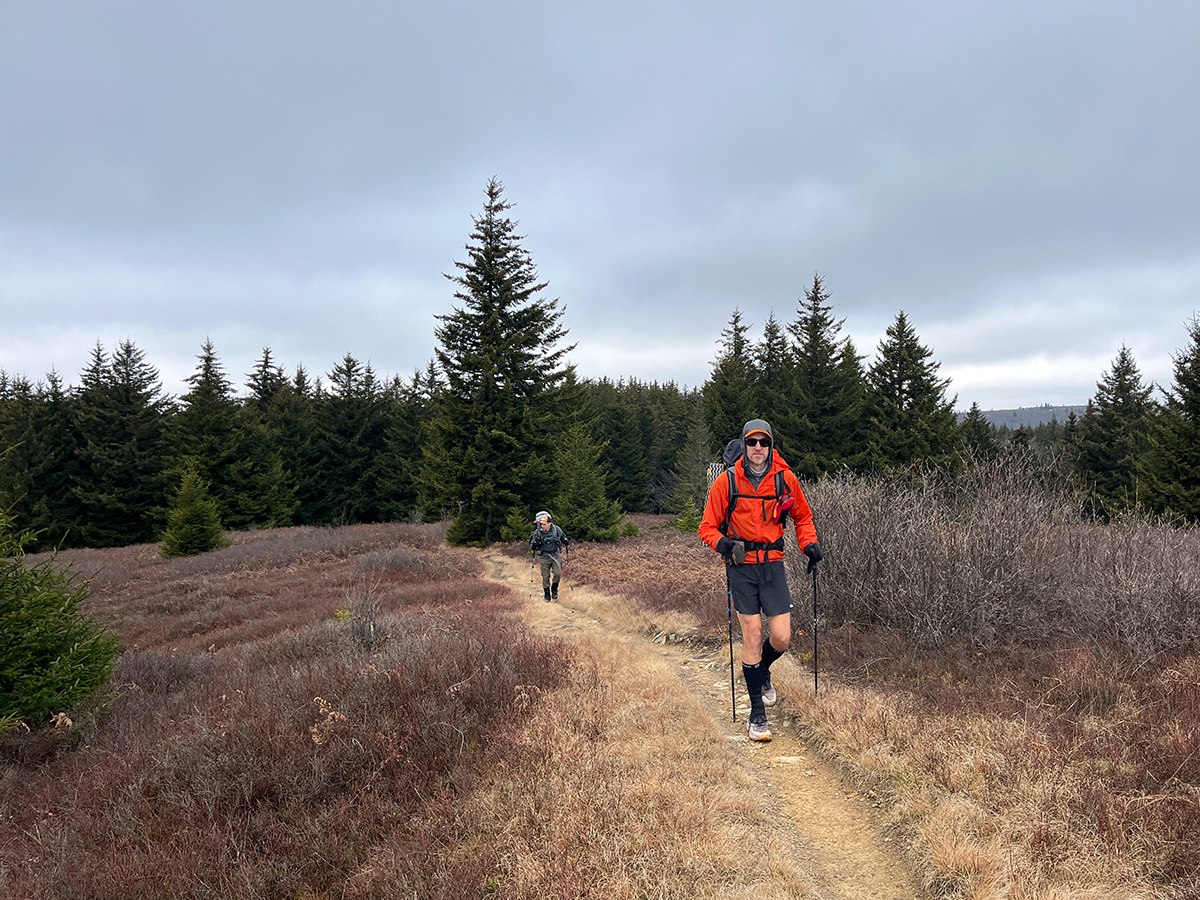
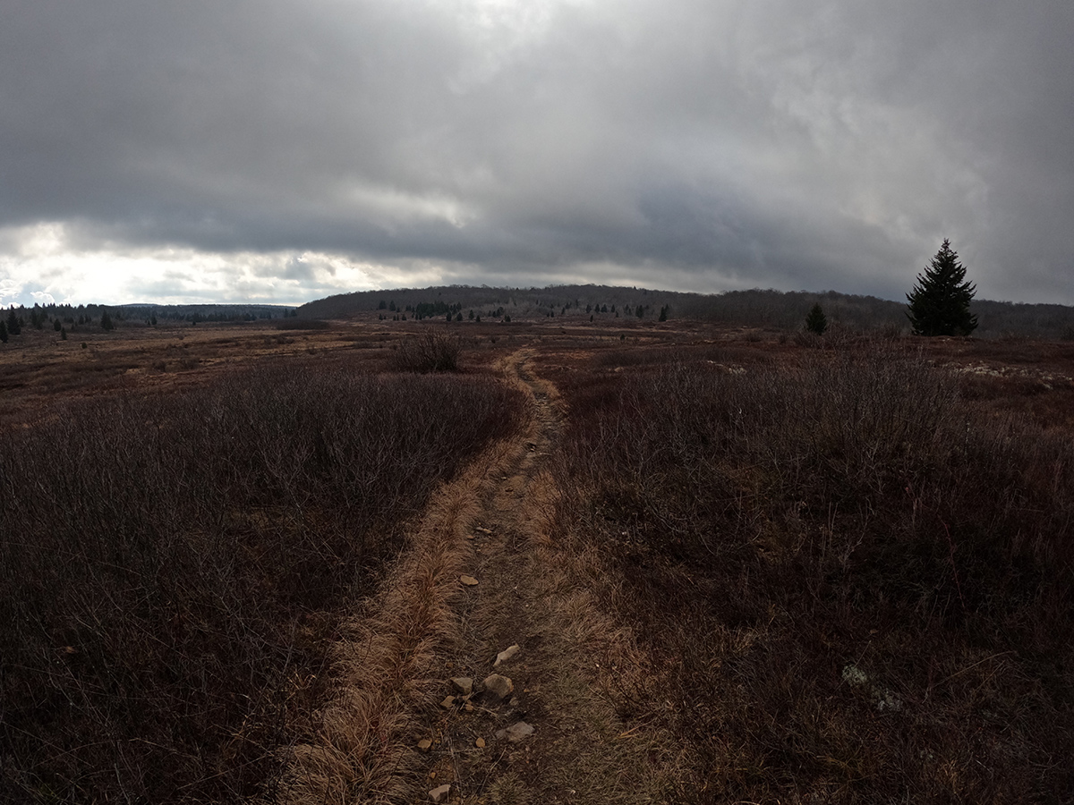
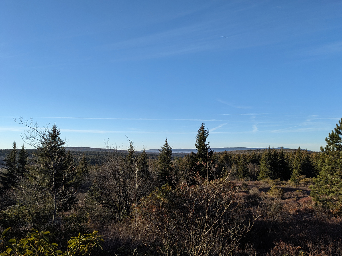
After the Rocky Knob section, which was pretty amazing with all of its rock formations, scenic views of the Canaan Valley, and spruce forest, we were on the wind swept portion of the plateau. This area is what I consider to be "True Dolly Sods" and otherworldly. It feels like the tundra of Canada with the atypical forms of vegetation and terrain. We moved through this area quickly because it was cold, windy, and exposed.
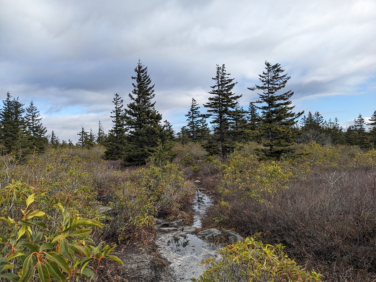
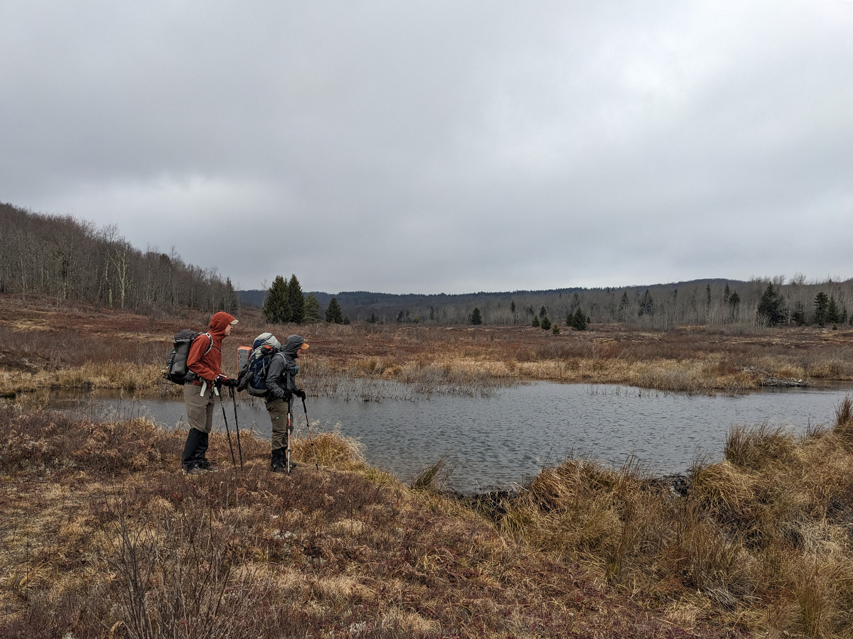
Eventually we made it to the top of Rocky Ridge Trail and began the turn to the east as it wraps around and eventually runs perpendicular to the gentle slope that makes its way back down into the Red Creek valley. There were a lot of spruce forests through this section which provided some nice shelter from the harsh wind. We made our way to Dobbin Grade Trail, hung a right, then a quick left onto Upper Red Creek Trail. We crossed Red Creek and paused to check out the beaver dam and found a good spot for lunch that was slightly out of the wind.
After a quick lunch, we set off along the Upper Red Creek Trail, winding through small stands of spruce. True to the trip’s theme, the trail remained stubbornly soggy, forcing us into a game of rock hopping to keep our feet dry. We eventually rejoined Blackbird Knob Trail, successfully completing our planned loop. Here, we faced a choice: push on toward the Red Creek Trail junction and head south or find a spot along Blackbird Knob Trail. Fearing high water levels where the two creeks meet along Red Creek Trail, we opted for the safer route. Heading back down Blackbird Knob Trail meant we had to cross back over Red Creek—the same one we’d tackled on Day 1—we were rewarded with a perfect campsite tucked just beyond the bank.
We set up camp, gathered fire wood, explored the area and found some other amazing campsites that we'd definitely try to remember for next time. The rest of the evening was spent drying out our wet shoes/feet, eating dinner, and enjoying the warm campfire. Day 2 complete!
Day 3
1.68 miles | +348 ft. of gain | -112 ft. of loss
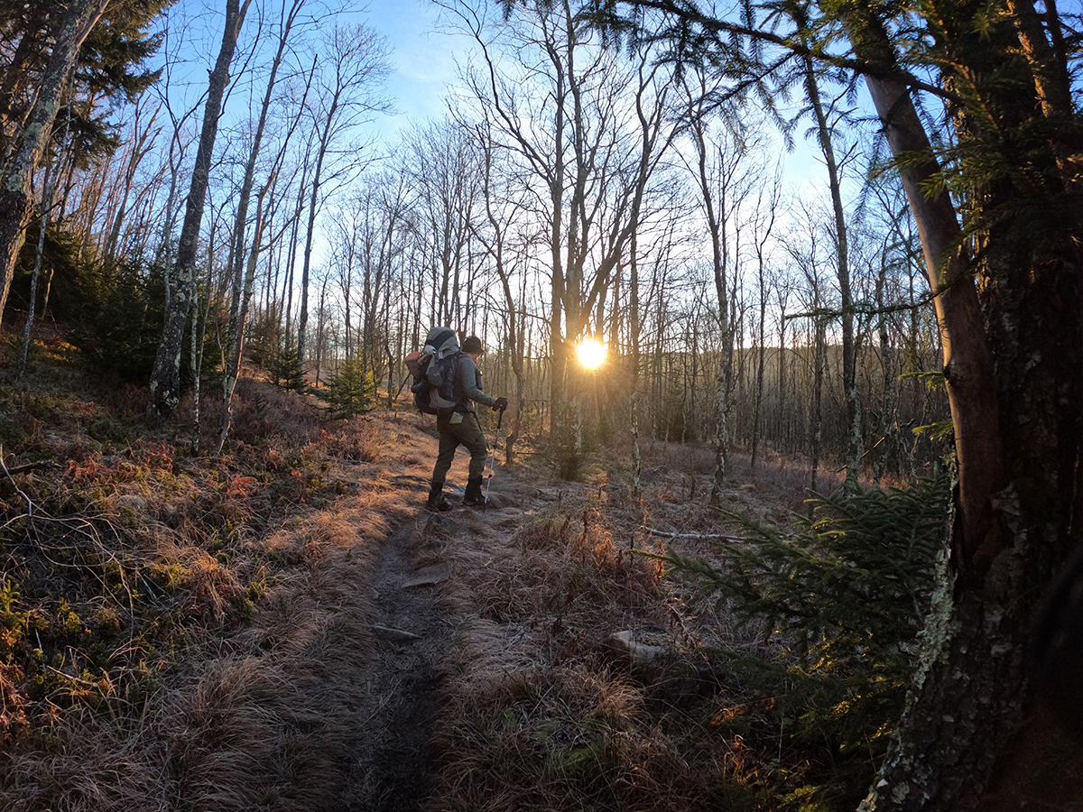
We awoke around 6:00 a.m. and got coffee and breakfast going. After breaking down camp, we were on the trail by about 7:30 a.m. It was a quick hike out to the cars but we heard gun shots off in the distance due to it being the first day of deer hunting season. We moved cautiously with this in mind as we hiked. What was muddy 2 days prior had frozen over into a nice crust. Though there were still sections of rock hopping, we were able to successfully keep our feet dry. We paused in a few places to take pictures of the beautiful sunrise and before we knew it, we were back at the trailhead. After signing the trail registry, we got our cars packed, chatted for a bit then said our goodbyes. Trip complete!
Key Considerations and Pro Tips
Navigation
Hiking in wilderness areas, like Dolly Sods, often means trails are not marked with blazes. Be very proactive with navigation. This means planning ahead of time and studying maps, having the route loaded on your device, and having a paper map backup (along with a compass). Even experienced hikers can get off-trail quickly.
- Use GPS/Apps (But Have a Backup): Phone apps such as Gaia GPS or AllTrails are invaluable tools, but they can fail due to battery life or signal loss.
- Carry Analog Tools: Always pack a physical map and a compass.
- Know How to Use Them: The map and compass are useless if you don't know how to orient your position and take a bearing. Practice your skills before you enter the wilderness.
- Check Constantly: From the start, make a habit of frequently cross-checking your paper map and GPS device against your surroundings.
Pro Tip: Plan using AllTrails, Gaia GPS, or CalTopo and generate PDF maps that can be printed off on Terra Slate paper via a laser printer.
Wet Feet
Every time I have visited Dolly Sods I have had to contend with constantly wet and muddy trail conditions. One way or another, my feet have always gotten wet (even when wearing nice waterproof boots... somehow the water is always deep enough to get over the Goretex membrane). And then there's the creek crossings with always variable water depth conditions. Sometimes there are enough exposed rocks to hop across but more often than not, my feet have inevitably gotten wet. Bringing extra socks is a must. Maybe even extra extra, as in 2 additional pairs than what would normally be packed.
Crowds
Once away from the busy trailheads, seeing people out on the trails is a possibility; both dayhikers and backpackers. If solitude is the goal, try visiting in the off-season (just be prepared for more radical shifts in the weather).
Wildlife & Food Storage (Bear Safety)
The Dolly Sods Wilderness is situated in prime habitat for black bears and other opportunistic wildlife. While bear canisters are not strictly required on this route, properly hanging your food and scented items is highly encouraged and essential for a safe and responsible trip.
The most effective and common hanging technique is the PCT Method (Pacific Crest Trail Method), as it makes the food bag very difficult for a bear to knock down or reach.
Pro Tip: Look for a sturdy "Y" branch before sunset and throw your line over it so you are not scrambling in the dark to secure your food.
Final Thoughts
Being in the Dolly Sods wilderness is like entering a different world, offering a privileged opportunity to hike through its unique boreal forests and tundra-like bogs while taking in diverse landscapes and expansive views from trails like Rocky Ridge and Upper Red Creek. This is definitely a bucket list destination for backpacking and I hope to find myself there again soon.
For this trip, wet feet and cold footwear were a small price to pay for a weekend defined by great miles and even better company. No amount of soggy trails could dampen the sense of shared camaraderie and made every waterlogged mile worth it.